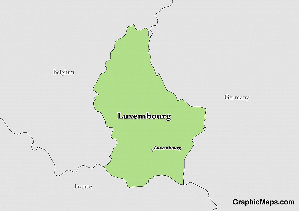
Luxembourg City is located in the southern region of the Luxembourg plateau. The city region is characterized by cliffs and valleys with rivers such as the Alzette and Petrusse Rivers. Despite being small in size, Luxembourg City is set on a rugged terrain. The city developed in the 12th century due to its strategic location suitable for military defense. The rugged terrain was used as hideouts in case of an attack. Many forts were built at the time to enhance the security of the residents. Germany occupied Luxembourg during the World War II, and made Luxembourg City its capital, due to the strategic military location. Luxembourg City was liberated from Germany on September 10, 1944.
As of 2016, the population of Luxembourg City is approximately 111,200 people. Luxembourg City is the most populated quadrant in the country. The population has been gradually increasing since 2004 when the city had a population of around 80,000 people. The city's metropolitan population, together with the surrounding areas like Sandweiler, Walferdange, and Strassen, is approximately 180,000 people.
Luxembourg City has a rich culture, making it a top tourist destination. The city attracts both local and international tourists. In fact, it was the first city to be recognized as the European Capital of Culture twice, in 1995 and 2007. Luxembourg City has a large number of museums for tourists to visit.
The climate of Luxembourg is generally referred to as mild oceanic climate. The winters are extremely cold while the summers are usually temperate. The city receives moderate precipitation. The rainfall is mostly attributed to the oceanic effect neighboring the city. Dry seasons are rare as the city is mostly moist. There are no extreme weather and seasons in the city. Over half of the year experiences moderate to heavy clouds.
This page was last modified on May 1st, 2018
More on Graphicmaps

Published on 2019-11-06
What is a Trade Embargo?
Published on 2019-11-04
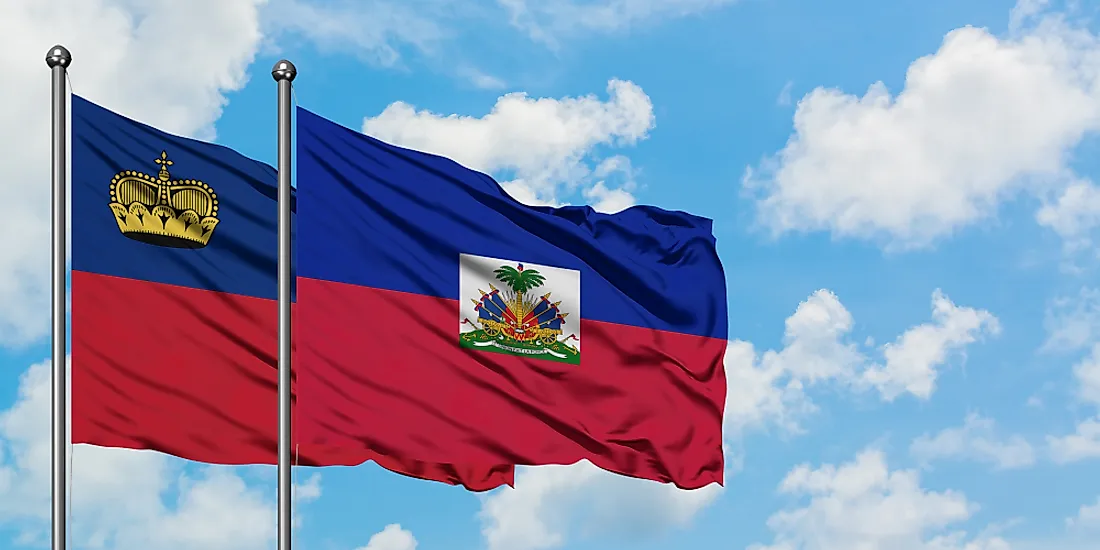
Which Two Countries Used to Have the Same Flag?
Published on 2019-09-16
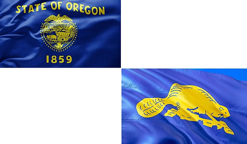
What Is the Only Two-Sided State Flag?
Published on 2019-09-16
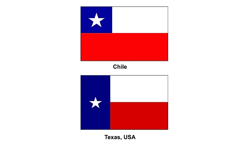
Which Country Flag Looks Like the Texas Flag?

Published on 2019-08-29
Flags That Resemble the US Flag

Published on 2019-08-20