
Bonaire, Sint Eustatius, and Saba are special municipalities of the Caribbean Netherlands. Bonaire, the largest of the islands, has Kralendijk as the capital city, Oranjestad is the capital city of Sint Eustatius, and the Bottom is the capital city of the Saba Island. The city of Kralendijk was built in 1639 as Fort Oranje to guard Bonaire’s main harbor. The town was later to be renamed Kralendijk by the Dutch colonial rulers in 1840. Being a port city, Kralendijk is situated in the mid-island on the western coast. Similarly, the city of Sint Eustatius, Oranjestad, was constructed as a harbor city in 1893. Oranjestad is also situated on the mid-western side of the island on the coastal side of the Caribbean Sea. In contrast, Saba, the smallest of the three municipalities, is the only one with its capital city situated inland.
The Caribbean Netherlands has the lowest population in the Caribbean region. Kralendijk, the largest of the three municipalities, has a population that is shy of 3,000 inhabitants. Oranjestad, the capital city of Sint Eustatius, is home to around 1,000 inhabitants. The Bottom has a population just shy of 500.
Caribbean Netherland cities are historic towns dating back to as early as 1600. Kralendijk, the largest of the three, has the highest number of historic sites, which number more than 26. Among them is the World War II Monument, built in memory of those who lost their lives during the war. Oranjestad is home to the oldest Jewish synagogue in the Western Hemisphere.
Kralendijk has a hot semi-arid climate, with uniformly hot and humid weather. The rainy season in the city is short, occurring between October and January. The Bottom has average monthly temperatures of 28°C with hot months starting from May to October. The city receives an average rainfall of 30mm. August and November receive high rainfall to the tune of 134 mm.
This page was last modified on May 1st, 2018
More on Graphicmaps

Published on 2019-11-06
What is a Trade Embargo?
Published on 2019-11-04
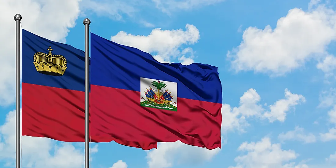
Which Two Countries Used to Have the Same Flag?
Published on 2019-09-16
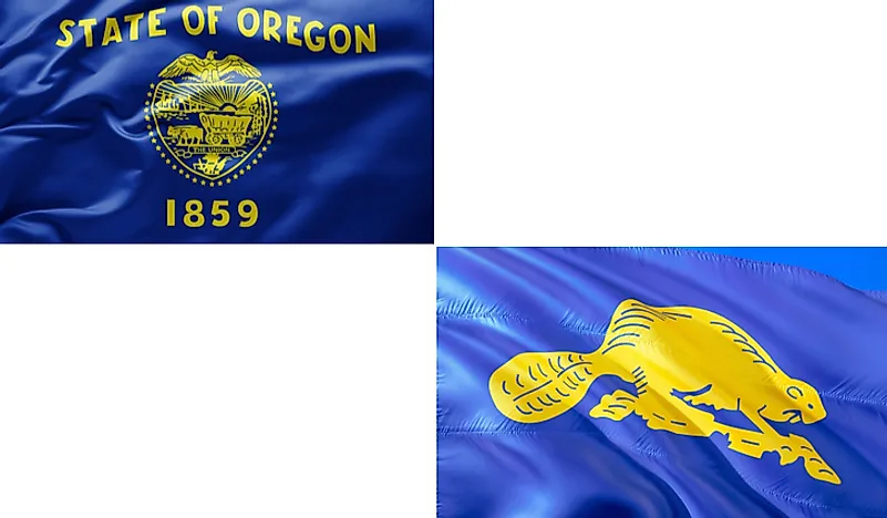
What Is the Only Two-Sided State Flag?
Published on 2019-09-16
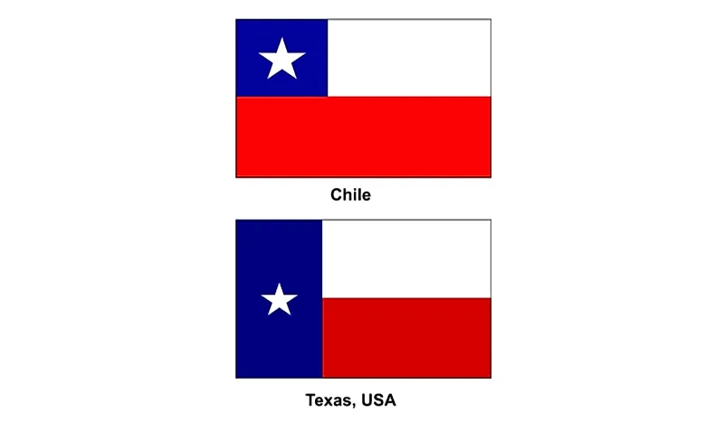
Which Country Flag Looks Like the Texas Flag?

Published on 2019-08-29
Flags That Resemble the US Flag

Published on 2019-08-20