
Bouvet Island is a remote island located in the south of the Atlantic Ocean. The island has no capital city. The island is a volcanic island, and it lies at the southern edge of the mid-Atlantic ridge. A glacier covers around 93% of the island's total area. The middle of the island is a volcanic crater filled with ice. In 1930, the island became a dependency of Norway and in the following year it was declared a nature reserve.
Bouvet Island has no residents. The first Norwegian exploration in the island was done by a group led by Harald Horntvedt in 1927. On December 1, 1927, Norway laid claim to the island, and on January 23, 1928, the request was honored by the United Kingdom, and they gave up their claim on the island. A second exploration mission was carried out in 1928 with the aim of setting up a meteorological radio station with staff on the island, but they could not find an appropriate location.
Bouvet Island is mostly inaccessible and most people who are visiting land in Larsoya, a nearby island. Larsoya was formed after a landslide, and it is home to the only weather station on Bouvet Island. Most people visit Bouvet Island between March and April. There is not much to see except for glaciers and some animals like the Macaroni Penguin, Adelie Penguin, Chinstrap Penguin, several species of seabirds, Antarctic fur seal and the Southern Elephant seals. The island is a nature reserve.
Bouvet Island experiences an Antarctic climate. The weather is mostly cloudy and foggy. The mean temperature is about 30 °F, and the island experiences the highest temperatures of around 37 °F between December and March. The lowest average temperature is about 23 °F, and it is experienced between July and September. Higher temperatures at some spots in the island due to solar radiation have been recorded.
This page was last modified on May 1st, 2018
More on Graphicmaps

Published on 2019-11-06
What is a Trade Embargo?
Published on 2019-11-04
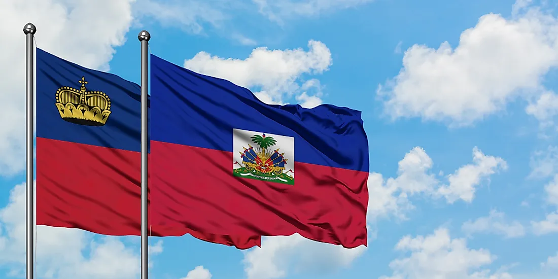
Which Two Countries Used to Have the Same Flag?
Published on 2019-09-16
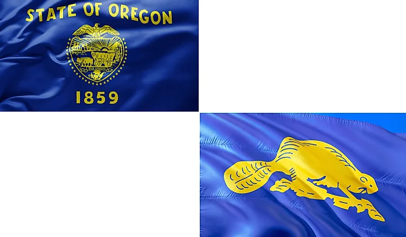
What Is the Only Two-Sided State Flag?
Published on 2019-09-16
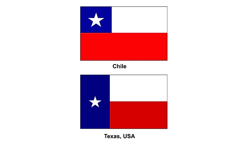
Which Country Flag Looks Like the Texas Flag?

Published on 2019-08-29
Flags That Resemble the US Flag

Published on 2019-08-20