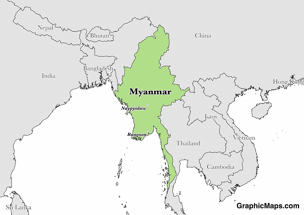
The capital city of Myanmar is Naypyidaw which is located in the central-southern region of the country. Naypyidaw has only been the capital city since the settlement of the area in 2005 and is unique in the fact it has been a planned city since the beginning of its existence. The city covers an area of 7,054.4 square kilometres (2,723.7 square miles) and is located between the Bago Yoma and Shan Yoma mountain ranges.
The population of Naypyidaw is estimated at 924,608 according to government figures. Many Asian cities experience congestion and overpopulation, however, Naypyidaw is not one of these cities with a population density of just 131 people per square kilometre (339.5 per square mile). Naypyidaw is divided into eight townships and the modern network of roads connect the sprawling city.
Naypyidaw's tourist attractions are centred around the amazing scenery and protected areas. The National Herbal Park, Naypyidaw Water Fountain Park, Zoological Gardens, Safari Park and the surrounding mountain ranges are all incredible experiences. The Ngalaik Lake Gardens water park is a small facility that is complete with pools, a beach, slides, and lodging. The two golf courses in Naypyidaw are also well worth playing.
The environment of Naypyidaw is considered a humid subtropical climate with larger seasonal variations compared to coastal Myanmar. The hottest month of the year is April with average high temperatures reaching 38 degrees Celsius (100 degrees Fahrenheit)and average lows hovering around 24 degrees Celsius (75 degrees Fahrenheit). Average lows only reach under 20 degrees Celsius (68 degrees Fahrenheit) from December-February and the rest of the year sees both lows and highs over 20 degrees Celsius. The wettest months of the year are July and August with averages of 198 millimetres (7.8 inches) and 229 millimetres (9.02 inches) of rain. Yearly rainfall averages 1,151 millimetres (45.33 inches) in Myanmar.
This page was last modified on May 1st, 2018
More on Graphicmaps

Published on 2019-11-06
What is a Trade Embargo?
Published on 2019-11-04
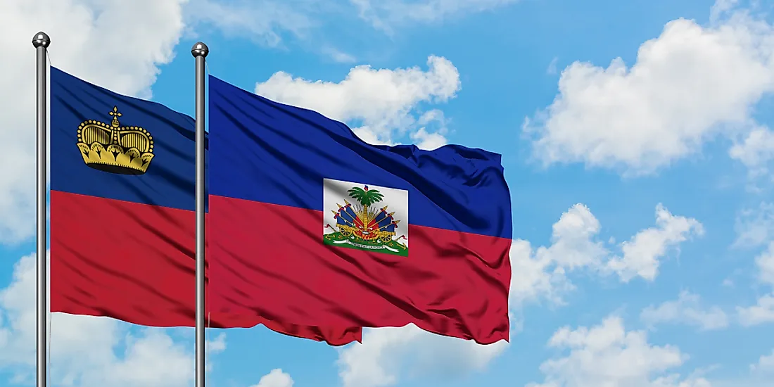
Which Two Countries Used to Have the Same Flag?
Published on 2019-09-16
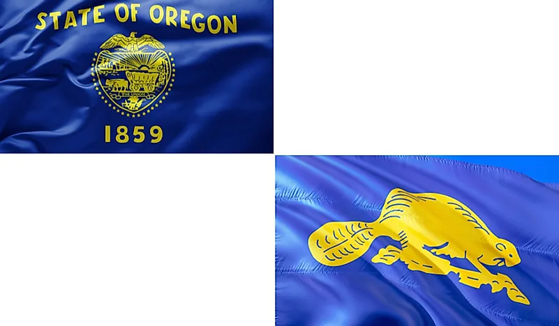
What Is the Only Two-Sided State Flag?
Published on 2019-09-16
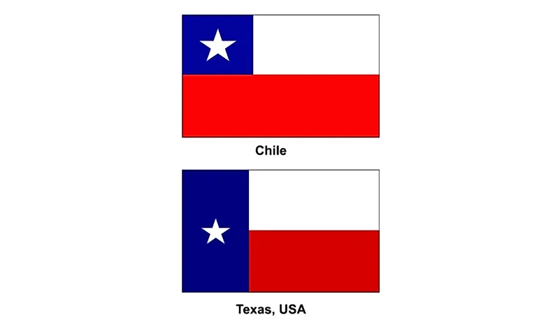
Which Country Flag Looks Like the Texas Flag?

Published on 2019-08-29
Flags That Resemble the US Flag

Published on 2019-08-20