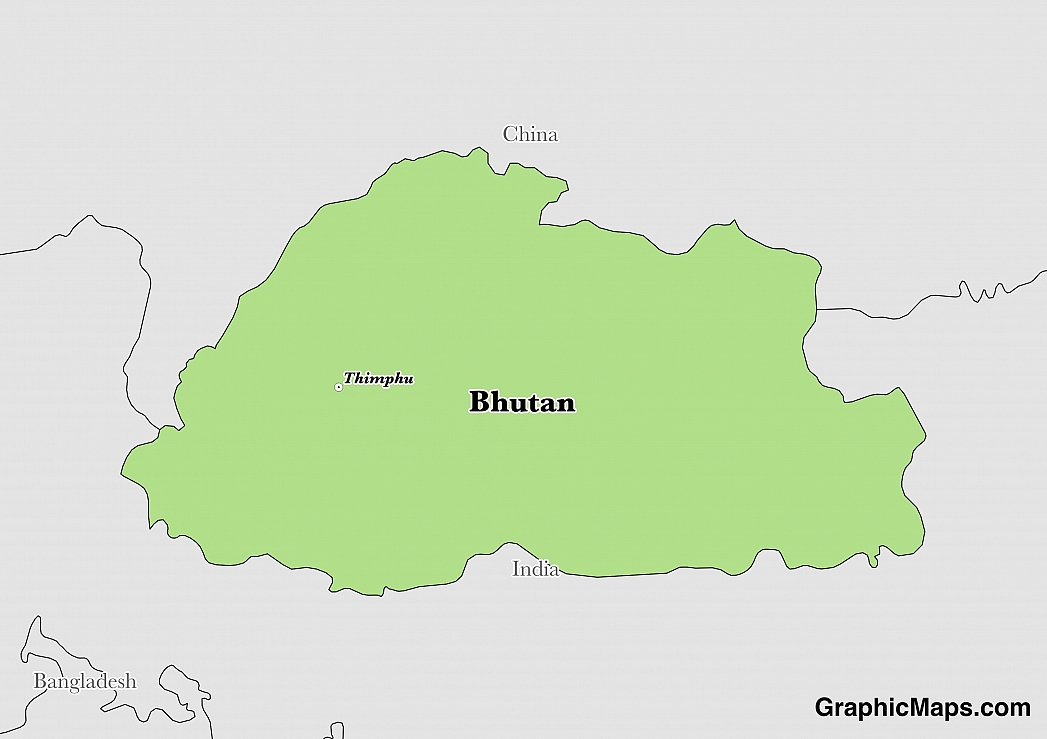
Thimphu is the capital, largest, and the only city of Bhutan. The capital is in the western central of the country within the valley of Thimphu District. Thimphu spreads out laterally on the western banks of River Raidak (Wang Chuu) and different parts of the city range between altitudes 7,375 feet and 8,688 feet. Thimphu became a capital in 1955 followed by an official declaration from His Majesty the Druk Gyalpo Jigme Dorji Wangchuck in 1961. The city’s total land area is ten square miles.
As of 2015, the population of Thimphu estimated around 104,000 a significant increase from 2005’s 79,185. The city has a population density of 7,850 square miles and most people depend on the dominant agricultural and livestock economy. Most of the people population resides in the city while a small number reside in the vast District of Thimphu.
Authorities in Thimphu highly regulates tourism although the sector contributes to the economy of the city. The purpose of this regulation is to maintain a balance between modernization, development, and tradition. Tourism initially involved visitors visiting and learning about Buddhism, weaving, birds, nature, and trekking. In the recent past, hotels and other tourism facilities have sprouted. Currently, there are various attractions like traditional Bhutanese architectural structures that decorate sacred places, royal palaces, and estates. Some of the architectural masterpieces are Drubthob Goemba, Tashichho Dzong, Tango Goempa, the Memorial Chorten, Dechen Phodrang, and Changangkha Lhakhang. In a bid to increase the tourism sector, the government built the National Textile Museum, National Library, National Institute for Zorig Chusum, Telecom Tower, National Institute for Traditional Medicine, Voluntary Artists Studio, and Royal Academy of Performing Arts among others. More notable attractions are the National Post Office, Clock Tower Square, and Motithang Takin Preserve.
The climate of the surrounding hills near Thimphu, the altitudinal range from 6,562 feet to 9,843 feet, is a temperate climate. As for the city in itself, it experiences monsoon-influenced Subtropical highland climate (Oceanic Climate), of a warm temperate climate. June to December experience a continuous southwest monsoon rainfall that causes occasional landslides and minor floods whereas the dry season runs from October to April. Annual precipitation levels range from 20 inches to 39 inches while the average winter temperature is around 41 °F to 59 °F and the summer temperatures vary between 59 °F and 86 °F. January and August are the coldest and hottest months of the year.
This page was last modified on May 1st, 2018
More on Graphicmaps

Published on 2019-11-06
What is a Trade Embargo?
Published on 2019-11-04
Which Two Countries Used to Have the Same Flag?
Published on 2019-09-16
What Is the Only Two-Sided State Flag?
Published on 2019-09-16
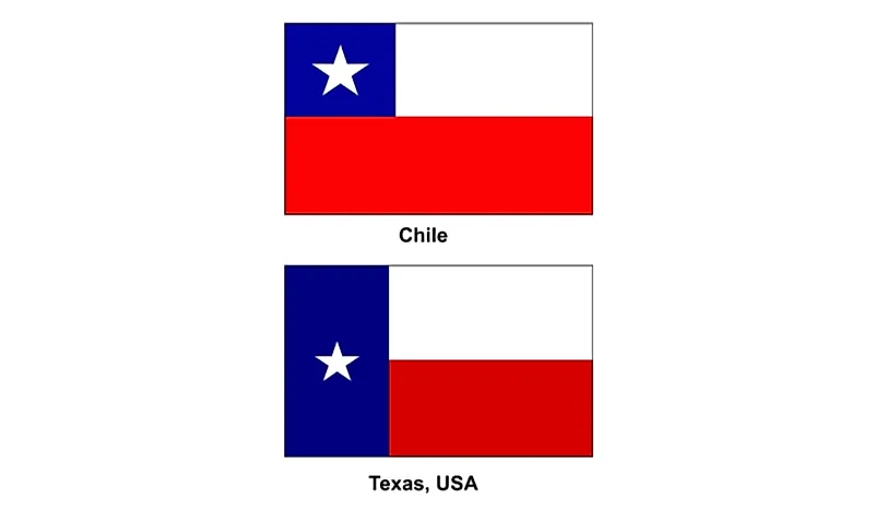
Which Country Flag Looks Like the Texas Flag?

Published on 2019-08-29
Flags That Resemble the US Flag

Published on 2019-08-20